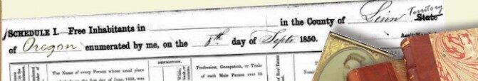
Oregon Territory Map – 1845
A Map of the Oregon territory and county boundaries as delineated in 1845.

Map copyrighted by the Oregon Historical Society. Grateful acknowledgement to Glenn Harrison, of the Linn County Historical Society who made the map available for inclusion on this site.